
Below are my photos from the duration of my stay in Tonga and they include dinner in the cave, island trip, tour of the island and some miscellaneous.

Oholei Beach.
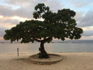
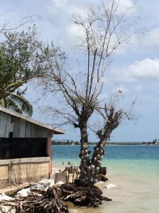
A single tree on Oholei Beach, with waves breaking on the edge of a reef in the background.

Oholei Beach Resort restaurant and bar.

Trees with surface roots on the rocks above Oholei Beach.

Traditional Tongan wood carving Tiki sculpture.

With the overcast sky the light fades early as night approaches and lanterns are lit on Oholei Beach.

Rock formation protruding from the reef surrounding Oholei Beach at low tide.
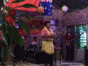
Oholei’s finest local band.

Mixed seafood platter at Oholei Beach Resort restaurant.
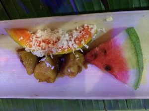
Fresh fruit.

After dinner floorshow with a faiva performance in Hina Cave (also known as Cave of Love) at Oholei Beach Resort.

Next up the fire eater.

Performer displaying his fire eater skills.

Me posing with the fire eater.

This is a heliotropium foertherianum flowering tree, commonly known as velvetleaf soldierbush, tree heliotrope or octopus bush.

Closer look at heliotropium foertherianum flowering tree reveals small green berries.
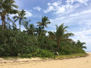
Palm trees rising above other green shrubs bordering the sandy beach.

Roots of this plant evident at low tide.

A solemn looking plant amongst small rocks on the beach at low tide.

Shipwreck off the coast of Pangaimotu Island.

Yacht moored off the coast of Pangaimotu Island.

Tree-lined sandy beach on Pangaimotu Island.
Tidal sea eroding the support around the base of a tree.
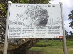
Introduction to Maka Sio’Ata (Tsunami Rock).

Maka Sio’Ata is a large stone boulder suspected to be the largest object moved uphill by a tsunami. It is believed that the tsunami that took place thousands of years ago moved the stone 100 metres.
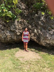
Close up of me standing in front of Maka Sio’Ata.

Just to get some idea of the size of Maka Sio’Ata compared to me. It’s approximately the height of a three-story building.

Hufangalupe (Pigeon’s Gate) is a natural land bridge on Tonga’s main island of Tongatapu.

The land bridge was formed by the collapse of the roof a sea cave.
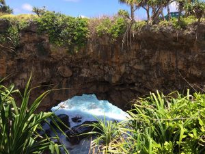
Hufangalupe land bridge.

The ancient locals believe that the land bridge was caused by Maui throwing his spear and making a large hole in the Earth.

Pineapple tree bearing fruit.

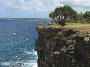
Cliff protruding over the Southern Pacific Ocean.

Waves crashing over rock ledges at the foot of cliffs on the ocean coastline.
Waves rolling in along the rocky Southern Pacific Ocean coast.

White water wake from the sea striking the rocks.

A rainbow above the sea created by the spray from the waves striking the rocks.

Rainbow above the sea with rocks visable in the clear ocean waters.

Waves rolling in on rock ledges and sea caves along the ocean coastline.
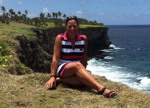
Me seated on the cliffs overlooking the Southern Pacific Ocean.
Pacific Ocean as seen through a hole in an overhanging cliff.

Rugged Southern Pacific Ocean coastline.

A collapsed roof of a sea cave revealing the ocean below.

Ha’amonga ‘a Maui (Burden of Maui), a thirteenth century megalithic stone trilithon, sometimes known as the Stonehenge of the South Pacific.

Me standing underneath Ha’amonga ‘a Maui.

Ha’amonga ‘a Maui (Burden of Maui).

Introduction to Maka Fa’akinanga (Leaning Rock). Maka Fa’akinanga is an upright stone slab, and it has markings resembling the indentation of a large head, shoulders, and back.

Maka Fa’akinanga (Leaning Rock). According to folklore the 11th Tongan King sat against it and struck out with a staff to keep people at a safe distance.
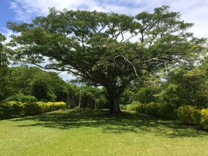
Large mature tree near Maka Fa’akinanga.
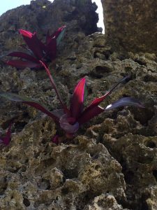
Red leafed plant growing naturally on eroded weathered stone.
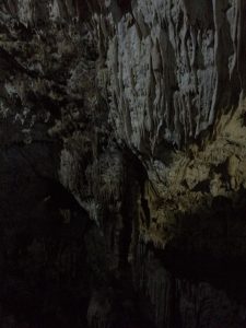
Anahulu Cave situated in the village of Haveluliku on the Eastern Side of Tonga.
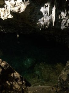
The Anahulu Cave contains freshwater pools.

Visitors swimming in a freshwater pool within the limestone cave complex.

Light shining into the limestone Anahulu Cave.

View across across the Southern Pacific Ocean to an outlying island in the distance. The waves are breaking away from the shore on the edge of a reef that protects the beach from the surf.

Local children playing in the ocean.

Man-made path between palm trees and green shrubs leading to a beach and ocean beyond.

Mapu’a ‘a Vaea (Chief’s Whistles) blowholes on Tongatapu Island.

The blowholes are caused by the strong surf forcing water up through eroded vents in the coralline limestone.

On a windy day with a strong swell the water jets from the blowholes can reach 30 metres into the air.

On an especially good day at Mapu’a ‘a Vaea, hundreds of blowholes spurt skywards at once.

The blow-holed riddle rocks stretch for 5km along the south coast of the island near the village of Houma.

Mapu’a ‘a Vaea (Chief’s Whistles) blowholes on Tongatapu Island.

Ray (my tour guide) and I.
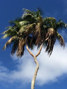
Three headed coconut tree, it’s rare and yes it is a tourist attraction.

Three headed coconut tree.

Patio area at Daysprings Lodge.

The Free Church of Tonga in Nuku’alofa. The church has been closed since February 2018 due to the damage it sustained during Cyclone Gita.

Damage caused by Cyclone Gita is clearly visable to the windows on the facade of the Free Church of Tonga.
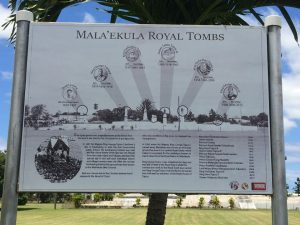
Introduction to the Mala’Ekula Royal Tombs.

The Mala’Ekula Royal Tombs are where the kings of Tonga and their very close relatives (wife and children) are buried.

View from The Top Restaurant towards the Royal Palace (large red roofed building) with a cruise liner berthed at Vuna Wharf in the background.

Dinner at The Top Restaurant.

Bit of a fuzzy photo from The Top Restaurant towards the Royal Palace as the light begins to fade as the evening draws in.
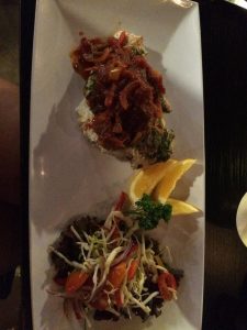
Beautifully presented dishes at The Top Restaurant.

As well as being beautifully presented dishes, they were delicious.

